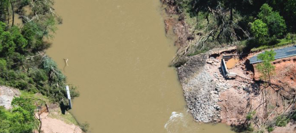
Before any work could begin, our team worked with MoDOT to begin securing permits from all appropriate parties, including state and federal agencies. With the old bridge washed a couple hundred feet downstream, permission was needed from the U.S. Forest Service, the agency that owns the public land along the river, to put in a temporary access road for removal, as well as construction at the current site. As part of the agreement with the agency, MoDOT made a commitment to clear out any damaged or downed trees caused by floodwaters.
The project required coordination with the U.S. Army Corps of Engineers, to work within a navigable stream; the Missouri State Water Patrol, to set up buoys around the old bridge to caution floaters and canoers; and the U.S. Fish and Wildlife Service, to monitor and protect the habitat of the Hellbender lizard, a protected species, during the removal of the old bridge and construction of the new one.
Solution
After just one week of design deliberation — including the review of all available hydraulic data — our transportation team proposed a four-span bridge, a change from the original three-span, to address the increasing frequency of heavy rainfall with a larger waterway opening. The revised design also lengthened the bridge from its previous 330 feet to 420 feet. For water to flow freely, our plans raised the grade by 1.5 feet and included a four-girder line University of Nebraska prestressed concrete arrangement to provide more capacity at a shallower structure depth and carry larger loads.
“The flow that comes through in a 50-year event (Q50) was coming right up to the top of the bridge,” says Michael Herleth, a project manager at Burns & McDonnell. “Now when a Q50 hits, we’ll have about a 3-foot clearance, making it capable of withstanding high-water flows.”
Though the latest bridge shares the same two-lane roadway design element as the original, a 26-foot road bed lined with rustic guardrail was specified within new contract plans, as were other structural adjustments, showcasing critical components of a much sturdier structure.
The new bridge span layout comprises three intermediate bents, which are the support structures located between the ends of the bridge, consisting of two columns — 3.5 feet in diameter — supported by 4.5-foot drilled shafts secured with a 10-foot rock socket. Reinforcing each bent is a web wall, which is a concrete barrier that fills the gaps between the columns, adding stability and helping divert debris coming from the river. It also serves as a stronger design element that can resist high water pressure in case another significant storm passes through the area.
The web walls and drilled shaft construction required approximately 40,000 pounds of reinforced steel, which was tied on-site and included in the contractor’s bid.
“The only thing that might knock this bridge down is a seismic event, which this area shouldn’t have to worry about,” Herleth says.